This page covers the routes that predated US 66 and the ones which make it up today.
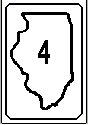
Illinois 4: It started life in the early 1920's as a route from Venice to Chicago as a northeast/southeast route, going through Edwardsville, Bloomington, and much of the old US 66 in Illinois. It appeared that IL 3 and 4 shared the same road from Venice to Mitchell. Known as the "Pontiac Trail", IL 4 was the predecessor to Rt. 66.
In the late 20's - early 30's, IL 4 was rerouted from the present day IL 4/IL 143 intersection near Marine northward to Springfield. The highway that went south of 143 was known as IL 43. In 1964, the section known as IL 43 became IL 4 for good. Today, Rt. 4 goes from Murphysboro (actually just north) to Springfield, and has not changed much since then.
US 60: Short-lived numbering for US 66 (for a few months in 1926).
Here is some more information about US 60 (from Mark Bozanich):
US 60 was the original number for US 66 from Chicago to Los Angeles. There is some doubt whether this number was actually posted or if it was a draft number that was never finalized.
I don't think US 60 was ever posted in the county. The locals have always referred it as Route 66.

US 66 entered into Madison County at Saunton paralleling the present-day I-55. In Edwardsville, 66 turned onto 157 and then west on Chain of Rocks Road just north of 270. There, it went through a once-powerful Route 66 community of Mitchell, known for the "Mustang Corral" and the "Bel-Air" drive-in. Mitchell was the gateway to the islands at that time, where 66 crossed the old Chain of Rocks bridge. (Later featured in the movie Escape From New York as the "69th Street Bridge".) In 1967, the New Chain of Rocks bridge opened and after that year, 66 was routed around the city.
There was a city 66 route also, which crossed the McKinney Bridge via the way of Nameoki Ave. The original crossing over the river in 1926 was via the McKinney Bridge; that changed the in 1929 when the privately-built Chain of Rocks Bridge opened.
For more information on Route 66, go to route66.netvision.be on the WWW. Edwardsville Intelligencer has a Route 66 Special on their web page. Other Madison County Route 66 info can be found at the chevytrucks.org site.
Some additional Route 66 sites:
Route 66 in Reverse from Chicago to Joplin. This page has been forwarded to the St. Louis section.
The original route of US 66 followed what had originally been IL 4. This route entered Madison County at Staunton and continued via Edwardsville and Granite City to Venice. From Venice, US 66 crossed the Mississippi River on the McKinley Bridge to St. Louis, MO. In the mid 1930's, after the completion of the Chain of Rocks Bridge across the Mississippi River and Lindbergh Blvd. around the St. Louis area, US 66 was routed W from Mitchell via the Chain of Rocks Bridge around rather than through St. Louis.
This contrasts with the way that US 40 continued to pass through Downtown St. Louis with Bypass US 40 going around the city. By the late 1950's, the highway that was to become I-55 from Hamel to jct US 40 near Troy was opened. This highway was labeled US 66. From jct US 40, US 66 continued SW sharing the same roadway with US 40 to St. Louis.
Both US 40 and US 66 were shifted to I-55/I-70 from the Troy area to St. Louis when the Interstate was opened to traffic in stages in the early to mid 1960's. US 66 was decertified in Illinois in 1977.
US 66 Branches: There were some branches of Rt. 66 over the years, but after 1967, the only branch to remain was Business 66, which was cosigned with Business 40. Even that was gone in 1976. More about the other branches from Mark Bozanich:
City US 66
When US 66 was rerouted across the Chain of Rocks Bridge in the Mid 1930's, the older route via Downtown St. Louis became City US 66. By the mid 1940's, City US 66 had been switched from the McKinley Bridge to the MacArthur Bridge. When US 66 was switched from the Chain of Rocks Bridge back to the Downtown St. Louis area in the late 1950's, City US 66 in Madison County was dropped from the US highway system. This route in Madison County is now part of IL 203.
Bypass US 66
In the late 1950's when US 66 was rerouted from Hamel towards St. Louis, former US 66 thru Edwardsville to and across the Chain of Rocks Bridge became Bypass US 66. Bypass US 40 shared part of this route. As with Bypass US 40, Bypass US 66 was dropped from the US highway system in 1967 when I-270 was completed. Former Bypass US 66 from Hamel thru Edwardsville to the vicinity of I-270 is now part of IL 157.
For more about Route 66 in Illinois, go to Rich Carlson's Page.
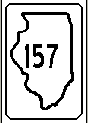
Illinois 157 used to be IL 150 up to the early 1950s for much of the route. The route went from Cahokia to Hamel and part of the route paralleled old US 66. The original route went from Columbia through Dupo and Cahokia (via old Rt. 3) and then NNE through Caseyville, Collinsville, and Edwardsville. It originally started at IL 4; today it starts at IL 3 and ends at IL 140.
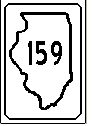
Illinois 159: Existing since the 1930s, until 1964, 159 went from Red Bud to Edwardsville then west to East Alton. The Edwardsville to East Alton route became 143 in '64. At that time, the route from Bunker Hill to Edwardsville, 112, became 159. 159 is known for massive bottlenecks in Fairview Heights and Edwardsville. (159 in Glen Carbon is only 2 lanes and locals are against any 159 realignment proposed by IDOT.)
However,
as of March 1998, there could be a new alignment for IL 159 planned in
the Edwardsville area. But the lack of funds for this one might put the
project on hold past the year 2000.